Dubos Point Wildlife Preserve Hiking Trails
Dubos Point Wildlife Sanctuary is a 36-acre peninsula that extends northeast into Jamaica Bay, bounded by Sommerville Basin on the east and Grass Hassock Channel on the west. Dubos Point was a salt marsh until 1912, when it was filled with dredged materials for a proposed real estate development. The project failed to materialize, and the site reverted to a natural state. Today, the center of the peninsula is covered by trees and salt tolerant shrubs, while the edges of the peninsula are low marsh or sandy beach. The marshlands help filter water pollution, reduce erosion from flooding, and sustain domestic and migratory birds including the merlin, peregrine falcon, snowy egret, herons, and a variety of duck species. The park is named for the environmentalist Dr. Rene Dubos and his wife Jean Dubos, who first coined the phrase “Think Globally, Act Locally” in his role as advisor to the United Nations Conference on the Human Environment in 1972. Dr. Rene Dubos died in 1982 and was survived Jean, who was the moving force behind the formation of this sanctuary. Its creation corresponds with the Dubos' vision of global environmentalism achieved through local action.
Blue Trail: At less than a quarter of a mile round trip, this short walk along the shorefront has views of the Sommerville Basin, the body of water separating Dubos Point Wildlife Sanctuary from Rockaway Community Park on its eastern side. Access this trail from the end of De Costa Ave and walk northward along the beach.
Red Trail: The Red Trail begins at corner of Bayfield Ave and Beach 65th St. Enjoy a short walk along the beach here for beautiful views of Jamaica Bay and the skyline of Manhattan approximately 15 miles off in the distance. Stay to enjoy the beach (no swimming permitted), the views and the sea birds from this quiet location in the Rockaways.
 Blue Trail
 Red Trail
![]() Point of Interest
Point of Interest
Points of Interest
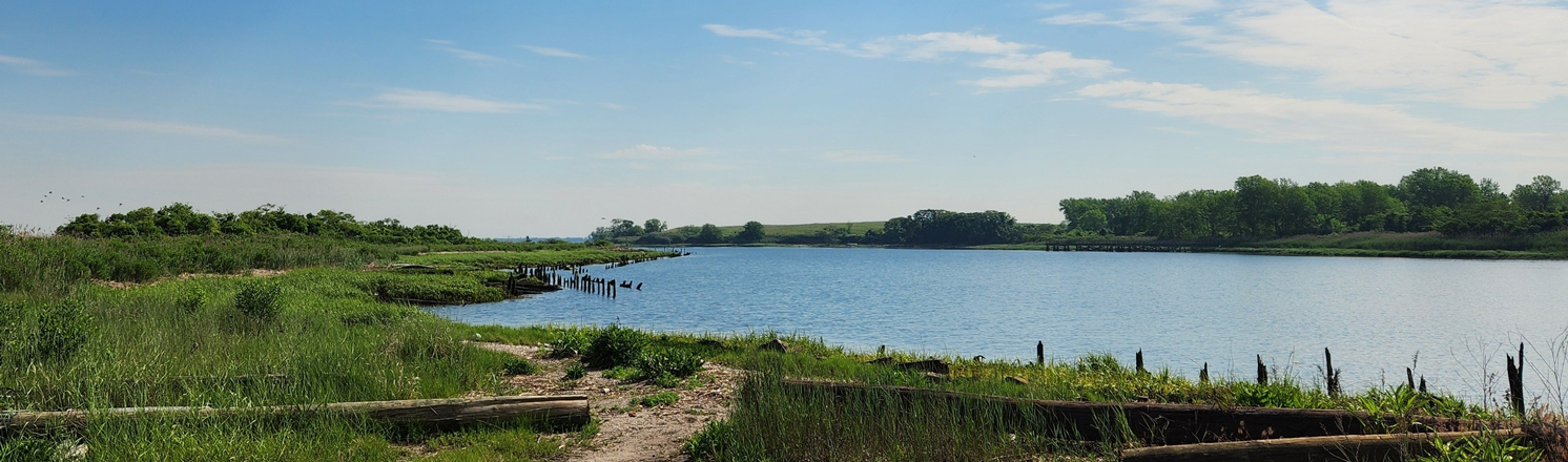
Sommerville Basin View
Just a few steps from De Costa Ave is beautiful view of the Sommerville Basin, an inlet of Jamaica Bay located between Arverne and Edgemere in Queens. Enclosed by the Rockaway Peninsula and protected from the Atlantic Ocean, the region of Jamaica Bay currently hosts over 325 species of birds, 50 species of butterflies, and 100 species of finfish. A favorite stop for migratory waterfowl, the area is an integral part of the larger, regional ecosystem. One of New York City's most extraordinary natural resources, Jamaica Bay remains largely undeveloped.
View Sommerville Basin View on the map
Jamaica Bay & Manhattan View
Rising above the foreground of sandy beach, choppy water, and salty marsh, the iconic skyline of Manhattan is visible from a distance of 15 miles away.
View Jamaica Bay & Manhattan View on the map
Hiking in NYC Parks
Visit our Hiking in NYC Parks page to find more nature trails in parks across New York City.
%7Cutmcsr%3D(direct)%7Cutmcmd%3D(none)%3B%2B__utmv%3D80545904.-%3B)