Eibs Pond Park Hiking Trails
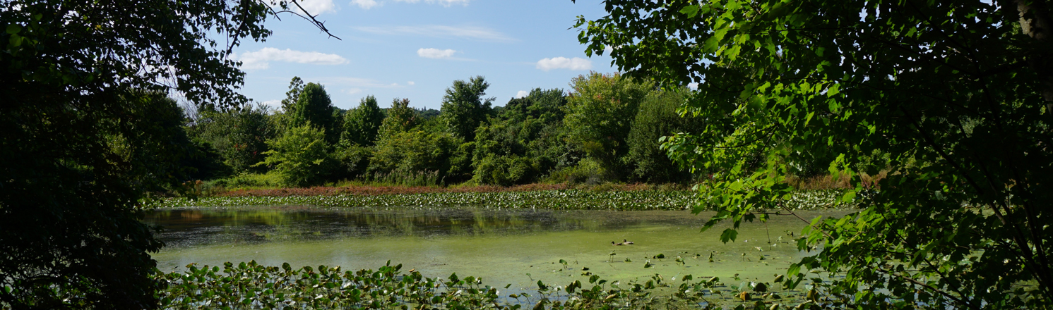
Despite this park's small size, it boasts the largest kettle ponds in New York City. Configuration of these kettle ponds has changed over the last hundred and fifty years due to land use and residential development. The southern half of Eibs Pond was filled in during the 1960's to become the parking lots and buildings of the Steuben Street Housing. Currently there exists four clay-bottomed ponds that are fed exclusively by runoff and rainwater with water levels that therefore vary season to season and year to year. Eibs Pond is the largest pond with a viewing platform with Small Pond located adjacent which also dries in the summer months. Hattie's Pond is to the north and connected via a small waterway to Small Pond closest to Mosel Ave. Together these ponds cover 3 acres of this 17-acre park. These ponds are considered kettle holes which were formed by the retreat of the Laurentide ice sheet that left masses of ice behind over 15,000 years ago. When the ice masses melted they left behind depressions under layers of sediment.
Eibs Pond Park also has a rich modern history. The area was used as farmland until 1899, before serving as a cricket ground, golf club, movie set, and military hospital. The area was largely abandoned for 40 years after World War II, until Eibs Pond became New York City parkland in 1989 with major restoration efforts to clean and improve the park by the community in the late 1990's. Today it offers visitors a quiet escape into nature.
Blue Trail: At over 1/2 of a mile, this trail provides views of both Eibs Pond and Hattie's Pond. From Hanover Ave, just south of Palma Drive, pass through an area where pine forest, grassland, and wetland meet the trail bring you to Hattie's Grove Scenic View Point, where you can pause and enjoy the view across Eibs Pond. This area is named for Reverend Hattie Smith-Davis (1925-2004), former President of the Fox Hill Tenant Association who collaborated with the Parks Council to secure grants to complete major restoration of the park.
Back on the Blue Trail, follow it away from the platform to the north. This next section can be wet, so be sure to walk on to the planks on the ground called “puncheons” to keep your feet dry. The trail comes to a forested intersection. Turning right at this intersection to pass by the pale trunks of a gray birch forest and follow along the banks of Eibs Pond to exit the park on Weser Avenue. If you instead turn left at the intersection, follow the trail north for views of Hattie's Pond on your left. Continue to creek crossing where you can take a break on a bench located there. Continue on along the northern edge of Hattie's Pond heading back to Hanover Ave where you began your walk.
Interactive Map
 Blue Trail
 Unnamed Official Trail
![]() Point of Interest
Point of Interest
Points of Interest
Hattie's Grove
The viewing deck on the western side of the pond is named for Reverend Hattie Smith-Davis (1925-2004), who led the Fox Hills Tenants Association in 1999 as they collaborated with the Parks Council to secure $200,000 from various grant sources and federal agencies. These funds, in addition to the efforts of a summer youth employment program, led to a major restoration to the park, including soil and water quality improvements. The viewing deck is a great place to look out at the flora and fauna of the park. The ponds and forest provide habitat for over 80 species of birds. Bulrushes, cattails, and water lilies grow in the shallow waters, while bluegill sunfish and largemouth bass swim nearby. Monarch butterflies can often be seen stopping over nearby as they migrate from North America to Mexico.
View Hattie's Grove on the map
Hiking in NYC Parks
Visit our Hiking in NYC Parks page to find more nature trails in parks across New York City.
%7Cutmcsr%3D(direct)%7Cutmcmd%3D(none)%3B%2B__utmv%3D81258456.-%3B)