Jamaica Bay Park Hiking Trails
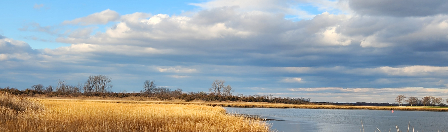
Jamaica Bay is an 18,000-acre wetland estuary surrounded by the Rockaway Peninsula to the South, Brooklyn to the West, and Queens to the East. Comprising an area almost equal to that of Manhattan, the bay consists of numerous islands, a labyrinth of waterways, meadowlands, and two freshwater ponds. Protected by the barrier beaches of the Rockaway Peninsula. The salt marsh of Jamaica Bay has three distinct zones and consists of two plant communities. The mudflats are at water's edge, an unvegetated zone only visible during low tide. The intertidal (low marsh) consists of pure saltmarsh cordgrass (spartina alternifolia), the most salt tolerant species whose roots and partial stems are flooded twice daily by high tides. Lastly, the high marsh (salt meadow) consists of a variety of less salt tolerant plants that live in the peat, out of range of most high tides.
In 1974, The Jamaica Bay Wildlife Refuge was incorporated into the newly formed Gateway National Recreation Area. The remaining parcels of Jamaica Bay Park still operated by NYC Parks include the area near the Queens borough - Nassau County border located on the southwestern shore of Motts Basin and the Joseph Sanford Jr. Channel of Jamaica Bay.
Blue Trail: Since 2018, NYC Parks, Natural Areas Conservancy and Jamaica Bay - Rockaway Parks Conservancy have partnered to improve the Blue Trail bringing continuous access from NYC Parks' Jamaica Bay Park to the New York State owned Bayswater Point State Park. The trail begins at Edgewater Road near Bay 28 Street and continues north and west winding along the shrubby upland border of the salt marsh that is dotted with small patches of upland trees. Several scenic points can be found on short trails leading off the Blue Trail to the shore. The trail ends to the northwest where park users can continue into Bayswater Point State Park if they wish.
Interactive Map
 Blue Trail
 Unnamed Official Trail
![]() Point of Interest
Point of Interest
Points of Interest
Motts Basin Marsh View
Follow the unnamed official trail from the Blue Trail to a rocky outcropping with concrete infrastructure. This point overlooks the beautiful saltmarsh cordgrass of the low marsh, as well as the mudflats. Keep an eye out for wading birds doing their fishing such as egrets or herons.
View Motts Basin Marsh View on the map
Motts Basin View
This viewpoint is located a short walk to the shore from Edgewater Road and Granada Place and just off the Blue Trail. Once at the point, look to your left northwest across Motts Basin and the Sanford Channel to another remaining parcel of Jamaica Bay Park. You are viewing a part of Grass Hassock "island", actually a peninsula that juts out into the eastern end of Jamaica Bay, which is not accessible to the public.
View Motts Basin View on the map
Joseph Sanford Jr Channel & Manhattan Skyline
Rising above a foreground of beautiful saltmarsh cordgrass and the choppy water of the Sanford Channel and Jamaica Bay, the iconic skyline of Manhattan is visible from a distance of 15 miles away.
View Joseph Sanford Jr Channel & Manhattan Skyline on the map
Hiking in NYC Parks
Visit our Hiking in NYC Parks page to find more nature trails in parks across New York City.
%7Cutmcsr%3D(direct)%7Cutmcmd%3D(none)%3B%2B__utmv%3D29474196.-%3B)